Santiago de Puringla (Santiago Puringla)
Santiago de Puringla is a municipality in the Honduran department of La Paz. The municipality is situated on a plain bordered by the River Puringla. South of the municipality runs the River Lepasale.
Puringla means "Abundance of Pollen" in indigenous languages.
The original name of the community was Alguindia. In 1691, it was founded with the name Puringla and was given the categorisation of municipality in 1886. On 5 September 1921, as an act of celebration of the centenary of Independence, it was agreed to change the name to its current form.
In April 2020, the municipality suffered fires in large parts of Delicias.
Map - Santiago de Puringla (Santiago Puringla)
Map
Country - Honduras
 |
 |
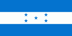
| Flag of Honduras | |
Honduras was home to several important Mesoamerican cultures, most notably the Maya, before the Spanish colonization in the sixteenth century. The Spanish introduced Catholicism and the now predominant Spanish language, along with numerous customs that have blended with the indigenous culture. Honduras became independent in 1821 and has since been a republic, although it has consistently endured much social strife and political instability, and remains one of the poorest countries in the Western Hemisphere. In 1960, the northern part of what was the Mosquito Coast was transferred from Nicaragua to Honduras by the International Court of Justice.
Currency / Language
| ISO | Currency | Symbol | Significant figures |
|---|---|---|---|
| HNL | Honduran lempira | L | 2 |
| ISO | Language |
|---|---|
| ES | Spanish language |


